|
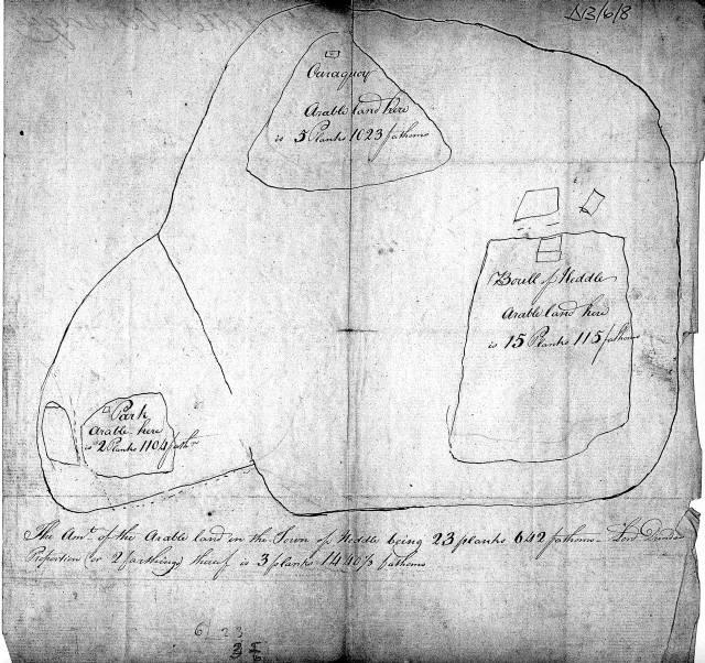
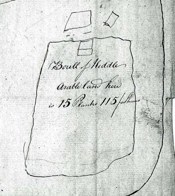
The sketch maps below date from 1817 and were drawn up as rough notes by the tax assessor of the time. The Boull of Heddle is a corruption of the old Norse BU which indicated the primary Manor of the tunship, which corrupted to township. The writing on the sketch states;
The amount of arable land in the township of Heddle being 23 planks, 642 fathoms. Lord Dundas (or 2 farthings) proportion being 3 planks 1440 fathoms
Tunships, however, where not in any sense towns. They referred to an area of enclosed land. This enclosure was by turf banks about six foot high built up as physical boundaries - fences or walls replaced them later. The tunship was then divided into the better land, directly controlled by the dwellings within it, with the balance being common grazing. On the sketch this is represented by the outer boundary line representing the poorer common land and the inner boundaries being the direct farm holdings. The tunship was assessed solely on the arable (better) land, so in this instance the Boull of Heddle held 15 planks out of the 23 planks encompassing the tax liability of the tunship.
A fathom is still used as a nautical measurement and has ancient origins, as do all old measurements, in practical human experience.
With such a strong Norse connection the Orcadian fathom probably derives from the old Norse Favn, the distance measured between the fingertips of a pair of spread arms, an average which on an adult male approximates to six feet. This is the common meaning of fathom whatever the etymology and such a basic measurement that it explains why it still is in use today. A plank derives from the French planche which never seems to have become a widespread term of land measurement equating to an area 40 fathoms square, or 6400 square yards which in toadys terminology is about 1.33 acres. Planking was also a verb, which meant dividing the land of a tunship into more manageable sections than the old run-rig medieval process.
It was in fact a term describing modernising effort by the landholders of the time. In 1817, the Boulle had 20 acres of good land. Today the term Bu is still used and tends to be limited to one (the biggest) farm per parish, if that.
The other dwellings in the tunship sketch still exist. They would have begun life as umbesettrs of the Bu, or under-settlements. Orraquoy is today owned by our neighbour, Laurie Sparrow. A Quoy (pronounced Kvi) is a common place name in Orkney, and means enclosed common hillside land.
Orra means occasional, thus Orraquoy was originally part of common tunship which was used for occasional (summer) pasture and would have become established as a dwelling for farm labourers at the Boulle. The Park is about a mile to the West and is still a working farm. Park is not an old term, being brought in with the Scots from the 17th century, it simply means an enclosure of grazing land. The absence of East Heddle at this time almost certainly means that at some point between 1817 and 1865 (where East Heddle can be seen) the Bulle divided its land, probably between two brothers, and the dwelling East of Heddle was built.
|